
Course C
Course C
Duration 1.5
Medium
-384 m 384 m
Altitude Minimum altitude 859 m - Maximum altitude 1062 m
Length 11km
Pratical information
Trail
Lakes, rivers and waterfalls
Landscapes
Loop
Markup:
Access
| Access | From Champagnole, follow the direction of Foncine-le-Haut taking the N5 then the D16 and the D127 to Foncine-le-Bas. Then take the D437 towards Mouthe and join Foncine-le-Haut. |
| Recommended parking | Parking near the Tourist Office |
| The start | Tourist Office, Foncine-le-Haut |
| Checkin | Tourist Office, Foncine-le-Haut |
A good summary of curiosities and trails in Val Foncine are to be discovered, in particular the source of the Saine, the Roche Fendue belvedere and the numerous pastures.
Indications
1. Since Foncine-le-Haut - Village, head towards the source of the Saine, going up through the pastures along the Saine. Pass the posts At Vallet and Bayard pasture to join the Source of the Healthy, remarkable natural site.
2. At the Source of the Healthy, retrace your steps and Bayard pasture, take the direction of Bayard and passant Under the Bayard et Roman life.
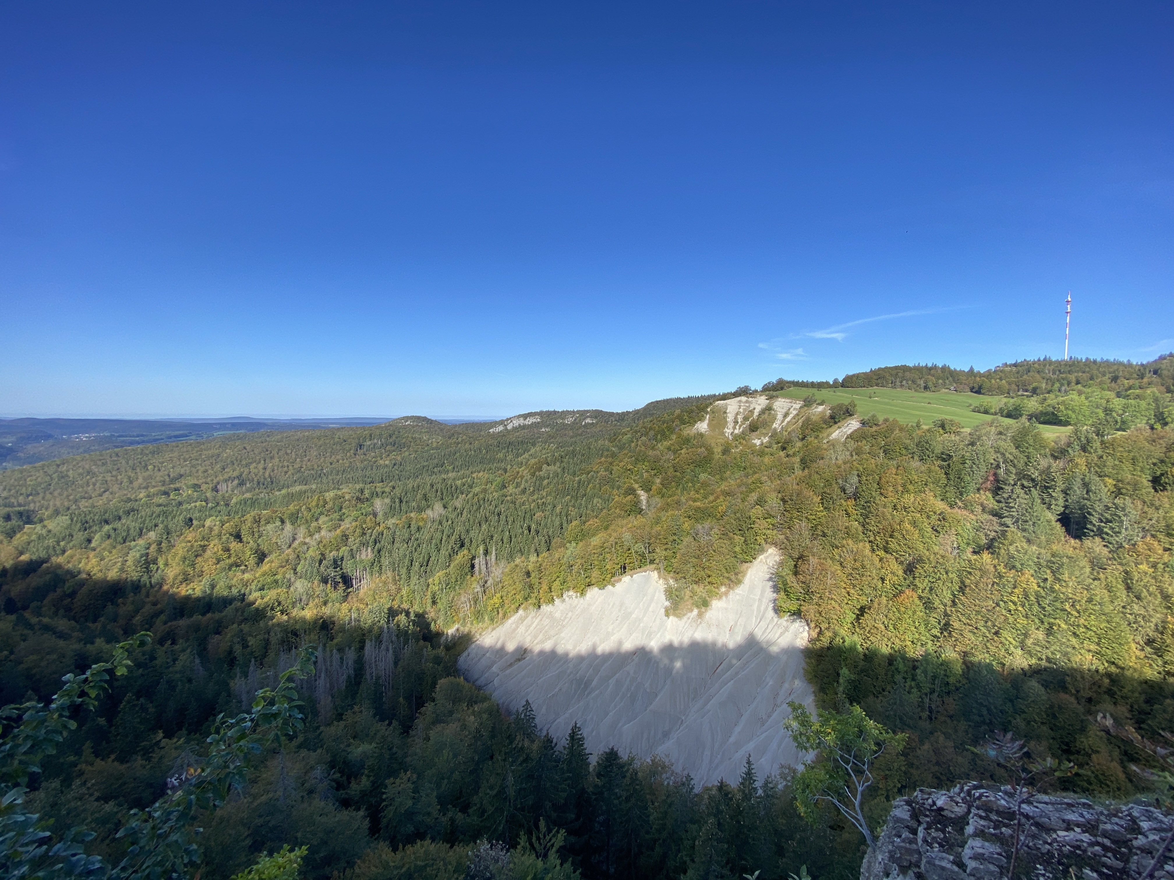
3. To Bayard, join the Belvedere of Roche Fendue (panoramic view) through the forest passing through the Combette aux wolves.
4. To Belvedere of Roche Fendue, take the direction of The ruins through the forest passing through the Bayard Coast, Rue des Caches et At Rutillet, then the pastures to reach The Town of Ruins, then the town The ruins.
5. To Ruins, go back down into the valley through the pastures to reach the Chemin de St Roch. Continue along the Saine to reach the Lower Town from Foncine-le-Haut, then the post Life in Gayet.
6. Cross the main street to reach the Moulin Choudet then cross the Thiémont Bridge.
7. At the bridge, take the 2nd path on the right towards Chemin des Petetins, then turn left into the forest to reach the supermarket and the pole The Isles. Cross the Saine and reach the starting point at Foncine-le-Haut - Village.
2. At the Source of the Healthy, retrace your steps and Bayard pasture, take the direction of Bayard and passant Under the Bayard et Roman life.
3. To Bayard, join the Belvedere of Roche Fendue (panoramic view) through the forest passing through the Combette aux wolves.
4. To Belvedere of Roche Fendue, take the direction of The ruins through the forest passing through the Bayard Coast, Rue des Caches et At Rutillet, then the pastures to reach The Town of Ruins, then the town The ruins.
5. To Ruins, go back down into the valley through the pastures to reach the Chemin de St Roch. Continue along the Saine to reach the Lower Town from Foncine-le-Haut, then the post Life in Gayet.
6. Cross the main street to reach the Moulin Choudet then cross the Thiémont Bridge.
7. At the bridge, take the 2nd path on the right towards Chemin des Petetins, then turn left into the forest to reach the supermarket and the pole The Isles. Cross the Saine and reach the starting point at Foncine-le-Haut - Village.