
Mouflon Belvedere
Mouflon Belvedere
Duration
Medium
-199 m 200 m
Altitude Minimum altitude 960 m - Maximum altitude 1106 m
Length 7.5km
Pratical information
Hiking
Flora and fauna
Pastoralism and Agriculture
Forests
Loop
Markup:
Access
| The start | Combe Simon, Cerniebaud |
| Checkin | Combe Simon, Cerniebaud |
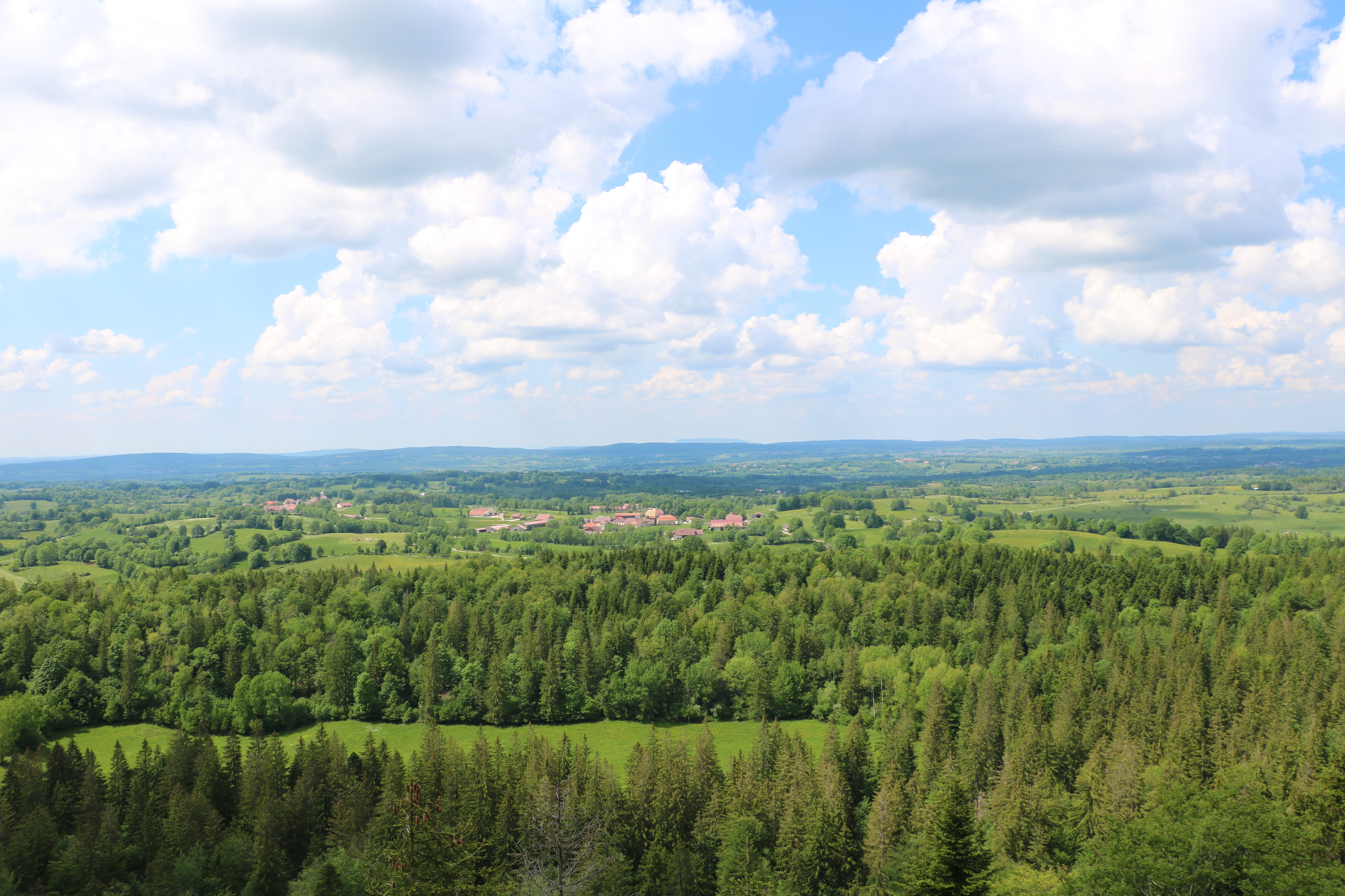
Do you like the views? U.S. too ! If it was necessary to establish a
“top 10” of the most beautiful panoramas of the Territoire Champagnole Nozeroy Jura, the Mouflon belvedere would certainly appear there.
“top 10” of the most beautiful panoramas of the Territoire Champagnole Nozeroy Jura, the Mouflon belvedere would certainly appear there.
We love it first and foremost for the landscape it embraces (the string of villages of the “Plateau de Nozeroy”, the Joux forest... and even Mont Poupet on a clear day...), but we I also love the splendid walk that leads there, between open clearings and
“Prince’s Forest”.
“Prince’s Forest”.
Indications
Take the road RD340 towards the village Cerniébaud. In the village, turn left and take a path between pastures and hedges in the direction of Reservoir.
Continue between paths and fields until Municipal by Fraroz. Then turn left onto the path that leads you to the Wind Turbine.
Continue in the forest until The Mouflon, (the belvedere is accessible back and forth). Go down the path to return to Combe Simon via The Touparon.
Hike n°5 of the CNJ Tourisme walking guide.