
Living waters, still waters
Living waters, still waters
Duration 2.5
Medium Difficult
-283 m 271 m
Altitude Minimum altitude 686 m - Maximum altitude 888 m
Length 9.7km
Pratical information
Hiking
History and Heritage
Lakes, rivers and waterfalls
Landscapes
Loop
Markup:
Access
| Access | From the N5 between Saint-Laurent-en-Grandvaux and Champagnole, exit at Pont de la Chaux and head towards Planches-en-Montagne. After Chaux-des-Crotenay, take the D127E1 to reach the car park. |
| Recommended parking | Champs-de-Mars, in the heart of the village towards Planches-en-Montagne |
| The start | Planches-en-Montagne |
| Checkin | Planches-en-Montagne |
Recommendations
Be careful during the 10 m crossing of the dark tunnel.
This route crosses pastures with livestock and follows forest paths. Also for the respect of the owners and operators who authorize you to pass, for the peace of livestock and wildlife, you are invited to stay on the marked trails.
Use the passages provided to cross the fences and make sure to close the barriers.
Please keep your dog on a leash if you have one.
Wildflowers are beautiful, they can be rare and protected and often wilt quickly. Don't pick them! They will delight future hikers.
In the event of forestry work (felling, skidding, etc.), for your safety, know how to give up and turn around.
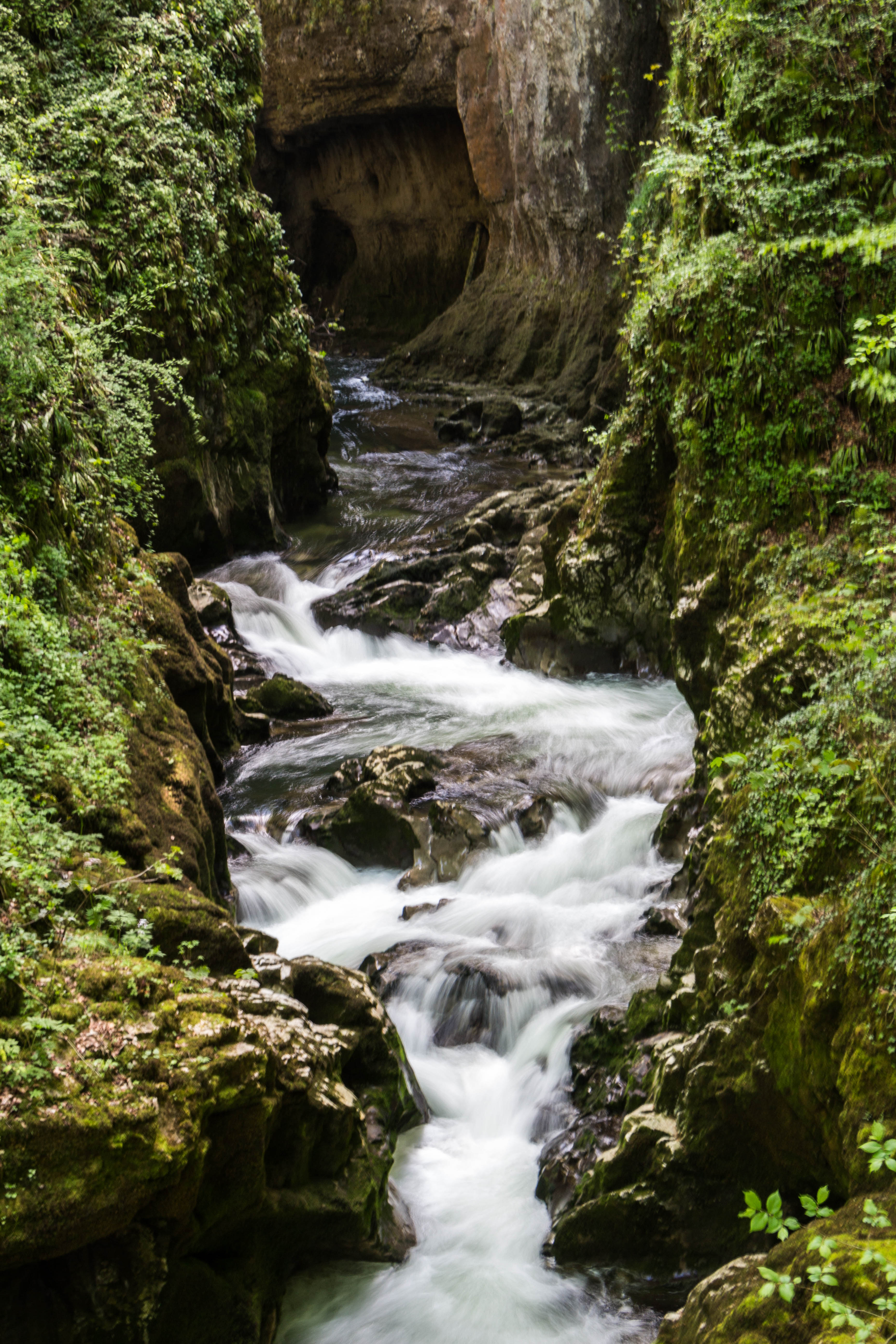
Impressive falls or intermittent cascades, deep gorges or small lakes: water is present throughout the circuit. Before providing electricity, it operated mills, sawmills, forges, eyewear factories, etc.
The Langouette gorges were dug by the Saine creating a 47 m deep canyon. You move between pots, jumps, waterfalls in a sumptuous landscape.
Official itinerary - Geotrek network of the Haut-Jura Regional Natural ParkIndications
- At the post The Martinet, leave the car park and cross the bridge. Go up the stairs on the left and follow the route laid out along the gorge. Arrive at the top of the car park, turn left (Chemin des Cascades) and join the D 127 at the exit of the village. Turn right onto the D 127.
- Au Girod, turn left towards "Malvaux" and climb onto a tarmac and then stone path. Cross the D 127.
- From the car park, take direction Lady Lake and follow the winding path for approximately 500 m. Go up to the right in the woods until the junction. Turn right then walk along the meadow, staying on the edge of the woods. Continue on the path which goes up through a beech forest, follow a stream then cross it on the right by a ford made of large stones.
- Walk along a meadow, climb into the woods and follow a farm path until Lady Lake. This lake full of fish is very rich in the flora that surrounds it. Turn left and reach the hamlet of Fumey.
- At the crossroads The Fumeys, cross the D 62 road and go down towards Foncine-le-Bas via the stone path.
- In the village at the post FONCINE-LE-BAS, turn left onto the D 127, cross it towards a square the field of Mars and follow a small road towards the Douanets Viaduct.
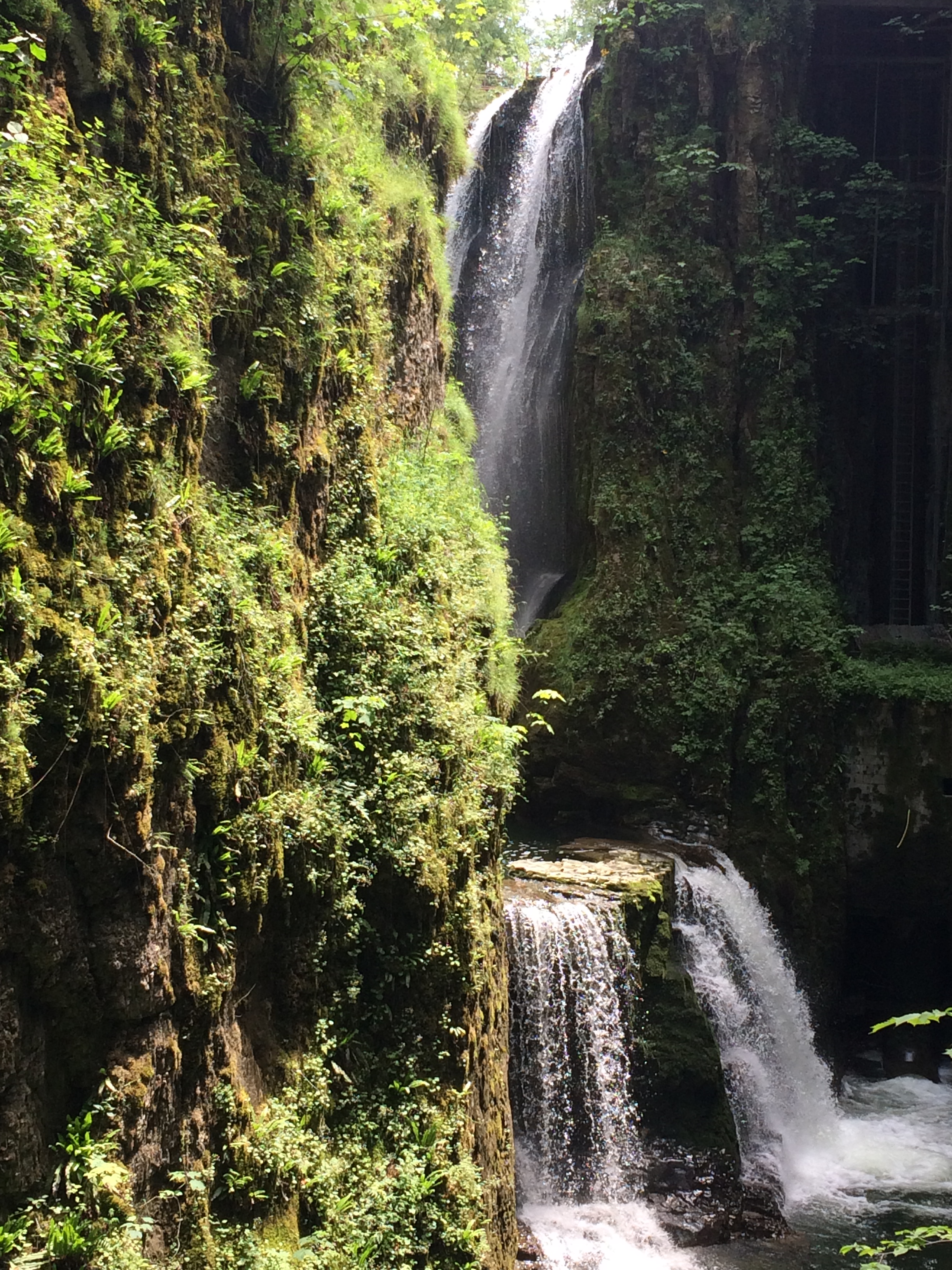
- Cross the viaduct and follow the direction of the Gorges de Malvaux via the post Tram'Jurassienne. Cross a 180 m tunnel then another viaduct (on your right the Bief de la Ruine waterfall). Follow the old Tram track into the forest.
- A under Bayard, continue straight until the crossroads. Turn left and go down towards Planches-en-Montagne, direction "Canal Usine Fumey-Badoz". Enter the village via Chemin des Chamois.
- At the crossroads BOARDS IN THE MOUNTAIN, turn right towards the town hall, go down and turn left to arrive at the starting point.